hankyoreh
Links to other country sites 다른 나라 사이트 링크
[Reportage] Coexistence of daily life and military division within the DMZ
“Things may be a little rough this year, but if we recruit talented people next year, we’ll be able to lead them forward with the spirit of Shangganling.”
These remarks were made in an interview on Chinese television on May 26 by Ren Zhengfei, founder and CEO of Huawei, the Chinese telecommunications equipment manufacturer that’s currently in direct conflict with the US. Amid an economic struggle with the US, China has recently been stressing the spirit of Shangganling(上甘嶺) in order to reinforce the Chinese people’s willingness to resist the US.
In China, the “spirit of Shangganling” refers to an indomitable commitment to overcome difficulties on behalf of the victory of the fatherland and the Chinese people, the determination to engage in battle with resolution, courage, and unity until victory is achieved.
Shangganling is a mountain located not in China but in Korea’s Gangwon Province. China lumps together the Battle of Sniper Ridge and the Battle of Triangle Hill, which were fought around Mt. Oseong in Gangwon Province in October and November of 1952 during the Korean War, as the Battle of Shangganling Mountain. China regards this battle as a decisive engagement that led to victory in the Korean War, which it describes as a “holy war” in which the Chinese forces defeated the American imperialists.
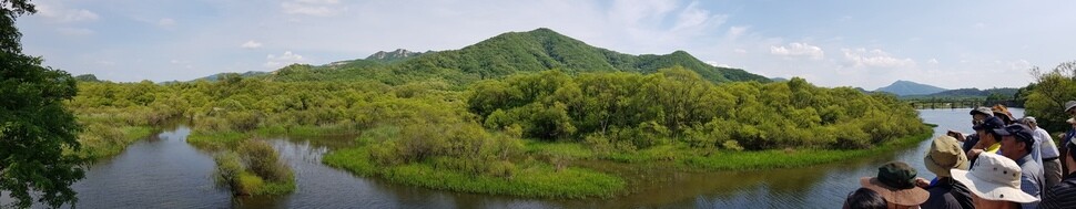
Participants at the Hankyoreh Peace Forum: Peaceful Ways to Use the DMZ, which was hosted by the Hankyoreh Foundation for Unification and Culture on June 14, looked at Sniper Ridge (Shangganling) from Victory Observatory (located in Geunnam Township, Cheorwon County, Gangwon Province). Sniper Ridge extends toward Gimhwa, near Namdae Stream, on Mt. Oseong, which is at the heart of the Iron Triangle. The fighting there was dubbed the Battle of Sniper Ridge by US troops, who took heavy losses from Chinese sharpshooters.
On the day of the forum, the woods on Sniper Ridge were at peace, and the Namdae Stream flowed at a leisurely pace. The area had the lazy vibe of a park in the early summer. But in the fall of 1952, 67 years ago, more than 20,000 young men were killed or injured in the attempt to take the square kilometer of land around Sniper Ridge. The steep loss of life of soldiers fighting in dense formations in this tiny area has no precedent in the history of global conflict.
According to Chinese records, the UN forces suffered 25,000 casualties and the Chinese suffered 11,000 casualties during 43 days, between Oct. 14 and Nov. 25, 1952. China argues that it won the battle, since it defended Mt. Oseong, which was a strategic stronghold. South Korean records state that the Chinese suffered 11,000 casualties and the UN forces 7,800. The ROK army also says it won the battle, since it maintained control of Sniper Ridge. The Battle of Shangganling Mountain didn’t end 67 years ago — memories of the battle are repeatedly recalled in the struggle between the US and China in geopolitics and the global economy.
20,000 young men died on Sniper Ridge during peace talks
Why did around 20,000 young people have to die at Sniper Ridge? During the two years that the armistice talks continued, from July 10, 1951, to July 27, 1953, the battle lines had frozen around the current Military Demarcation Line (MDL). During that period, fierce battles were fought in the hills on the central and eastern sections of the front in a bid to grab a few extra acres of land. The majority of military fatalities during the Korean War occurred during these highland battles. Along with the Battle of White Horse Hill, the Battle of Sniper Ridge is one of the best-known highland battles in the Korean War.
The reason the two sides couldn’t stop fighting there was because, while they knew they couldn’t win, they were determined not to lose, either. Unlike war, negotiations and dialogue can’t proceed when neither side is willing to give ground. Peace must be achieved through peaceable means. Establishing peace on the Korean Peninsula means dismantling the last remaining Cold War alignment. When lasting peace blossoms on the Korean Peninsula, the Battle of Shangganling Mountain will finally end for China as well.
The Hankyoreh Foundation for Unification and Culture held the Hankyoreh Peace Forum on peaceful ways of utilizing the demilitarized zone (DMZ) at the DMZ Ecological Peace Park in Cheorwon County on June 14 as an attempt to ease inter-Korean tensions and facilitate peaceful coexistence through the environment and ecosystem.
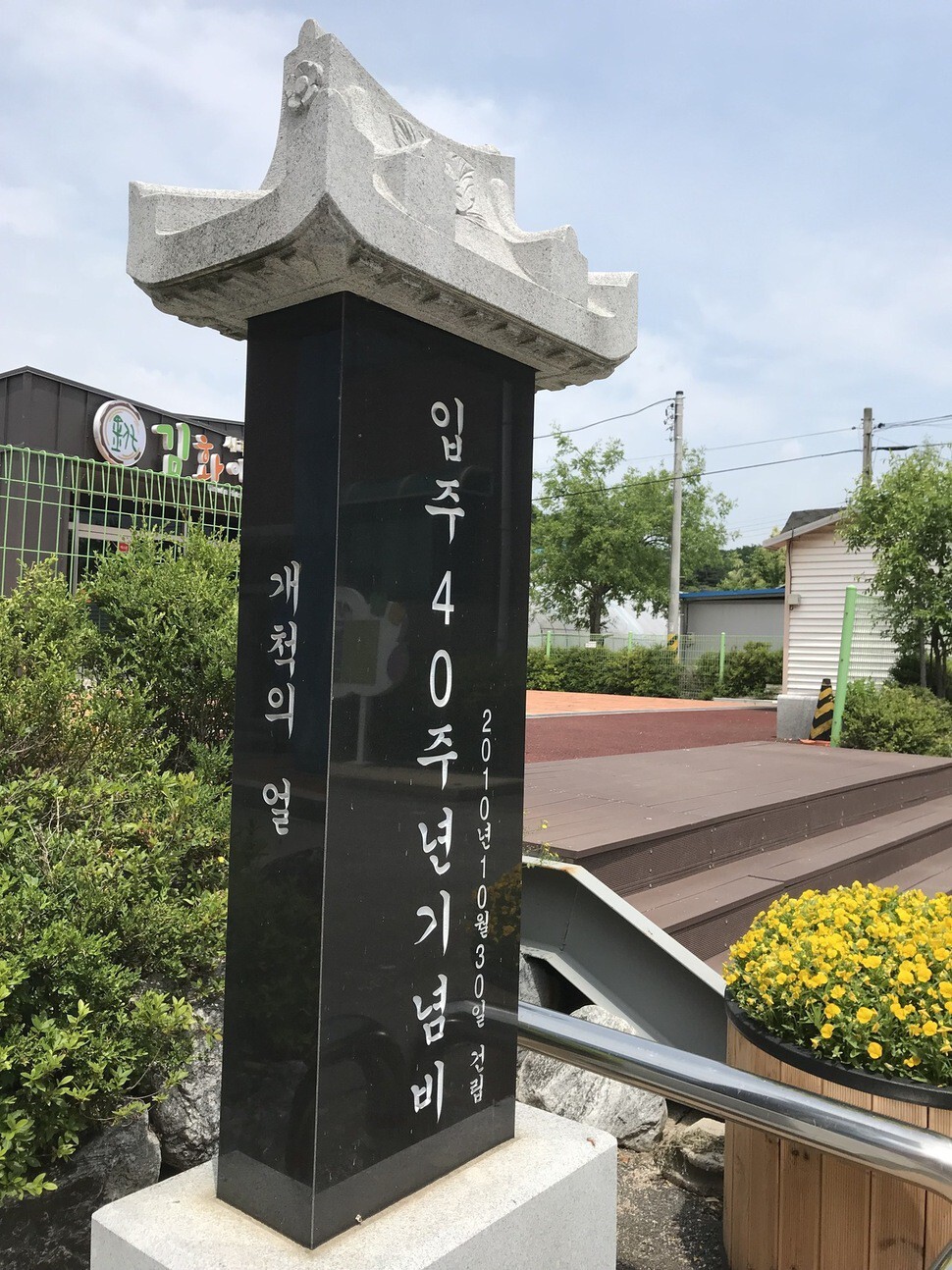
DMZ Ecological Peace Park is located in Saengchang Village, Gimwha Township, Cheorwon County, Gangwon Province, a village that’s a byproduct of the Cold War. On Oct. 30, 1970, at the height of the rivalry between the South and North Korean governments, 100 families of military veterans moved to Saengchang, which had been rebuilt. After recapturing Cheorwon during the Korean War, the South Korean government moved people into the village to farm the land with the triple goal of increasing food production, responding more quickly to a North Korean incursion, and aiding psychological warfare against North Korea. Modeled after Israel’s kibbutz communal settlements, the village combined the concepts of agriculture and warfare.
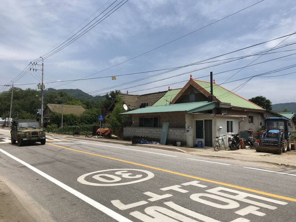
Cookie-cutter houses were built at the same time along the road at Saengchang and became the houses of 100 families. Even today, similarly looking houses built in the 1970s and 1980s line the road.
The Ecological Peace Park in Cheorwon County opened to the public in May 2016. The area, which had been closed off for more than 60 years, is veiled in secrecy, and it remains unmarked on maps for reasons of military security. But strictly speaking, it’s not part of the DMZ. The only places where ordinary people are able to enter the DMZ right now are in Goseong County in Gangwon Province and the DMZ Peace Road in Cheorwon County.
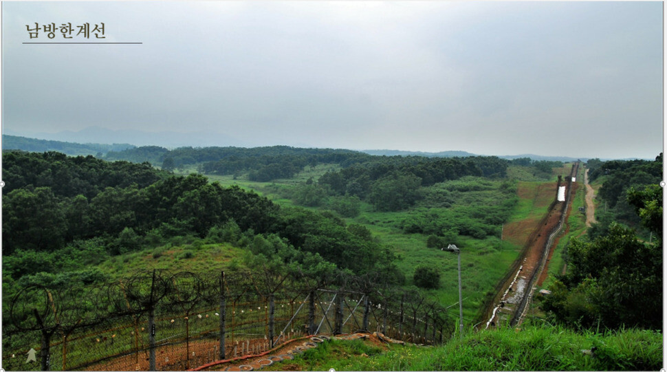
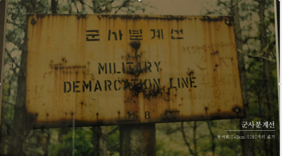
There are no barbed-wire fences along the Military Demarcation Line, which is frequently called the armistice line. It’s an imaginary, invisible line running between 1,292 signposts that were erected at 200m intervals from east to west across the Korean Peninsula. The barbed-wire fence that many assume marks the armistice line actually runs along the southern border of the DMZ, known as the Southern Limit Line.
In order to prevent clashes around the Military Demarcation Line (MDL), the Southern Limit Line (SLL) was established 2km to the south and the Northern Limit Line (NLL) 2km to the north. The resulting 4km buffer zone between these two limit lines is the DMZ. During times of military tension, South and North Korea have moved their limit line fences closer to the MDL, causing the actual area of the DMZ to shrink to about half its nominal size.
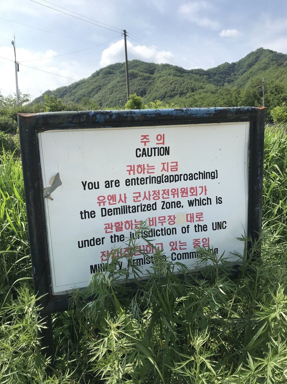
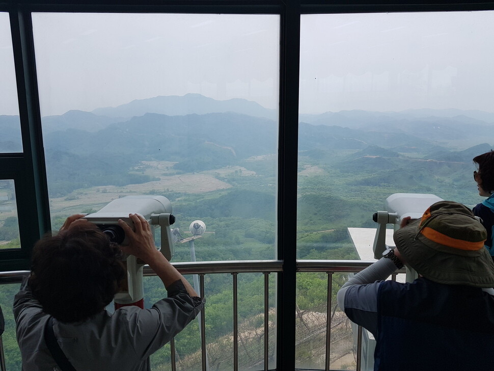
“Inside the DMZ, it’s possible to experience the high military tension. But because the area is so hilly and heavily wooded, it’s hard to get a good look at the traces of war, the ecological environment, and the natural scenery,” said Seo Jae-cheol, an advisor to an NGO called Green Korea who has conducted ecological and environmental surveys in the DMZ for more than 20 years. In a very real sense, you can’t see the forest for the trees.
Viewing the DMZ from Cheorwon County
The hiking trail at the DMZ Ecological Peace Park takes visitors all the way to the barbed-wire fence on the Southern Limit Line. “Walking along the trail, you’ll get a glimpse of the interior of the DMZ, including the minefields, guard posts, observation posts, and other military facilities built along the Southern Limit Line. You can see traces of an electric railway to Mt. Kumgang that was built during the Japanese colonial occupation and a pristine forest and other natural features of the East Asia temperate zone. You can get a better look at the DMZ here than by actually going inside it,” Seo said.
There are two trails at the DMZ Ecological Peace Park: Yongyang Weir Trail runs past a wetland lake to the barbed-wire fence at the Southern Limit Line, while Shipjatap (Cross Tower) Trail offers a glimpse into the DMZ in Cheorwon County.
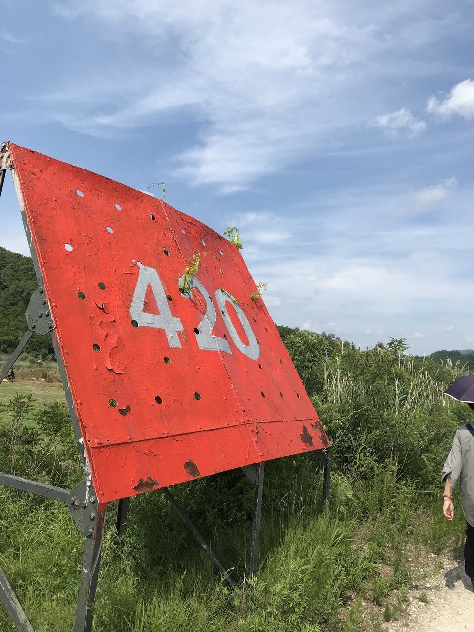
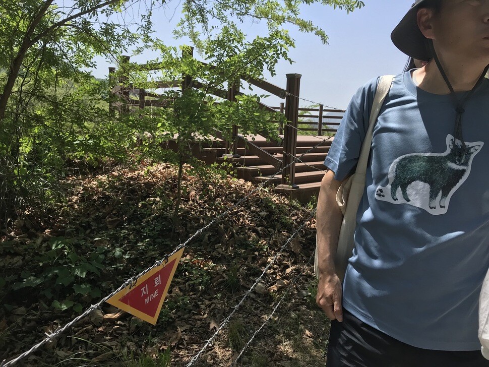
Participants at the Hankyoreh Peace Forum on June 14 said they were surprised by the juxtaposition of division and everyday life at the trails in the DMZ Ecological Peace Park. Fields planted with rice could be seen through the barbed-wire fence, and leafy trees with mulberries ripening on their branches stood next to a sign warning of mines. Everyday life and division weren’t far apart.
By Kwon Hyuk-chul, direct of the Hankyoreh Peace Institute
Please direct comments or questions to [english@hani.co.kr]

Editorial・opinion
![[Editorial] Does Yoon think the Korean public is wrong?](https://flexible.img.hani.co.kr/flexible/normal/500/300/imgdb/original/2024/0417/8517133419684774.jpg "[Editorial] Does Yoon think the Korean public is wrong?") [Editorial] Does Yoon think the Korean public is wrong?
[Editorial] Does Yoon think the Korean public is wrong?![[Editorial] As it bolsters its alliance with US, Japan must be accountable for past](https://flexible.img.hani.co.kr/flexible/normal/500/300/imgdb/original/2024/0417/6817133413968321.jpg "[Editorial] As it bolsters its alliance with US, Japan must be accountable for past") [Editorial] As it bolsters its alliance with US, Japan must be accountable for past
[Editorial] As it bolsters its alliance with US, Japan must be accountable for past- [Guest essay] Amending the Constitution is Yoon’s key to leaving office in public’s good graces
- [Editorial] 10 years on, lessons of Sewol tragedy must never be forgotten
- [Column] A death blow to Korea’s prosecutor politics
- [Correspondent’s column] The US and the end of Japanese pacifism
- [Guest essay] How Korea turned its trainee doctors into monsters
- [Guest essay] As someone who helped forge Seoul-Moscow ties, their status today troubles me
- [Editorial] Koreans sent a loud and clear message to Yoon
- [Column] In Korea’s midterm elections, it’s time for accountability
Most viewed articles
- 1‘Right direction’: After judgment day from voters, Yoon shrugs off calls for change
- 2[Editorial] Does Yoon think the Korean public is wrong?
- 3Strong dollar isn’t all that’s pushing won exchange rate into to 1,400 range
- 4Where Sewol sank 10 years ago, a sea of tears as parents mourn lost children
- 5Japan officially says compensation of Korean forced laborers isn’t its responsibility
- 6[Editorial] As it bolsters its alliance with US, Japan must be accountable for past
- 7[News analysis] Watershed augmentation of US-Japan alliance to put Korea’s diplomacy to the test
- 8Korea ranks among 10 countries going backward on coal power, report shows
- 9Faith in the power of memory: Why these teens carry yellow ribbons for Sewol
- 10[Guest essay] Amending the Constitution is Yoon’s key to leaving office in public’s good graces