hankyoreh
Links to other country sites 다른 나라 사이트 링크
Rapidly approaching Typhoon Hinnamnor as seen from space
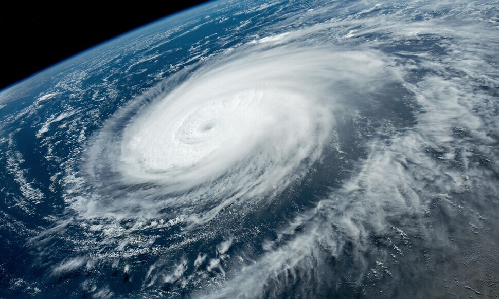
On Sunday, NASA Earth Observatory released two photographs of Typhoon Hinnamnor taken from space. One of the photos was shot by an astronaut on the International Space Station on the morning of Aug. 31, and the other by the Aqua satellite on Sept. 1.
NASA noted that Hinnamnor is Earth’s first Category 5 storm this year.
“It was pretty late in the year for the first storm of such intensity,” NASA said, adding that an average of 5.3 Category 5 storms form each year globally.
The storm category is determined by the amount of damage expected when a hurricane or typhoon makes landfall.
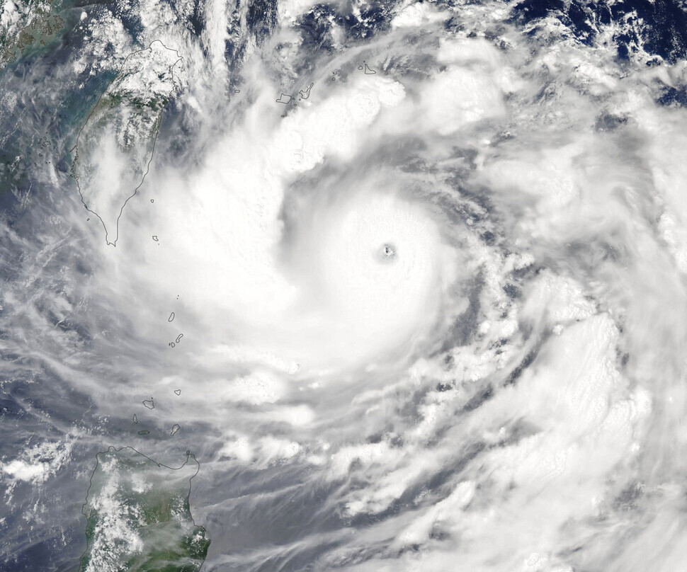
The Korea Meteorological Administration (KMA) reported on Sunday that Hinnamnor, the 11th typhoon of the season, had developed into a “very strong” typhoon, with an atmospheric pressure of 935 hectopascals and a maximum wind speed of 49 meters per second (109 mph) at the center and a maximum wind radius of 430 kilometers. As of 3 pm on Sunday, the KMA said, the typhoon was rapidly moving north-northeast from a position about 390 kilometers northeast of Taipei.
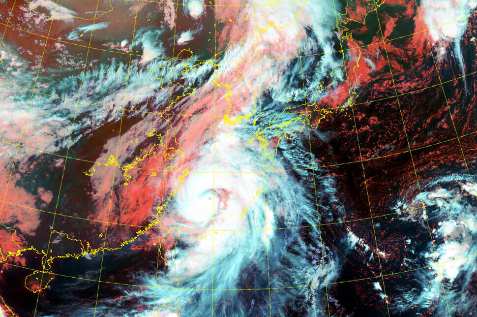
Within 24 hours of that point, Hinnamnor was expected to reach the waters 340 kilometers south-southwest of Seogwipo, a southern city on Jeju Island. After moving to a point about 50 kilometers east-northeast of Seogwipo around 3 am on Tuesday, it will then move in a northeastern direction.
The typhoon’s force is likely to remain “very strong,” representing a wind speed of more than 44 meters per second at the center of the storm, until that point.
By Lee Jong-keun, staff reporter
Please direct questions or comments to [english@hani.co.kr]

Editorial・opinion
![[Editorial] Intensifying US-China rivalry means Seoul must address uncertainty with Beijing sooner than later](https://flexible.img.hani.co.kr/flexible/normal/500/300/imgdb/original/2024/0517/8117159322045222.jpg "[Editorial] Intensifying US-China rivalry means Seoul must address uncertainty with Beijing sooner than later") [Editorial] Intensifying US-China rivalry means Seoul must address uncertainty with Beijing sooner than later
[Editorial] Intensifying US-China rivalry means Seoul must address uncertainty with Beijing sooner than later![[Column] When ‘fairness’ means hate and violence](https://flexible.img.hani.co.kr/flexible/normal/500/300/imgdb/original/2024/0516/7417158465908824.jpg "[Column] When ‘fairness’ means hate and violence") [Column] When ‘fairness’ means hate and violence
[Column] When ‘fairness’ means hate and violence- [Editorial] Yoon must stop abusing authority to shield himself from investigation
- [Column] US troop withdrawal from Korea could be the Acheson Line all over
- [Column] How to win back readers who’ve turned to YouTube for news
- [Column] Welcome to the president’s pity party
- [Editorial] Korea must respond firmly to Japan’s attempt to usurp Line
- [Editorial] Transfers of prosecutors investigating Korea’s first lady send chilling message
- [Column] Will Seoul’s ties with Moscow really recover on their own?
- [Column] Samsung’s ‘lost decade’ and Lee Jae-yong’s mismatched chopsticks
Most viewed articles
- 1Celine Song says she’s gratified global audiences have responded to the kismet of ‘inyeon’
- 2[Editorial] Transfers of prosecutors investigating Korea’s first lady send chilling message
- 3[Exclusive] Unearthed memo suggests Gwangju Uprising missing may have been cremated
- 4Highly educated high-earners at risk of being replaced by AI, BOK study says
- 5[Column] US troop withdrawal from Korea could be the Acheson Line all over
- 6Xi, Putin ‘oppose acts of military intimidation’ against N. Korea by US in joint statement
- 7For new generation of Chinese artists, discontent is disobedience
- 8Truth commission confirms Korean War killings by soldiers and police
- 9USFK sprayed defoliant from 1955 to 1995, new testimony suggests
- 10[Column] “Hoesik” as ritual of hierarchical obedience